| Item Detail |
| |
| |
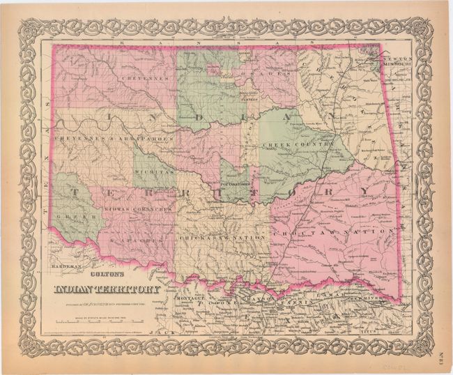
MapMaker: |
G.W. & C.B Colton [& Co.]
|
|
| |
| |
Subject: |
Oklahoma |
|
| |
Period/Size: |
1876 / 12.9" x 15.8" (32.8 x 40.2 cm)
|
|
| |
Color: |
Colored
|
|
| |
Condition: |
(A) Original color with light toning along the sheet's edges and a few short edge tears confined to the blank margins, most of which have been archivally repaired. (condition help) |
|
| |
Source: |
General Atlas |
|
| |
References: |
|
|
| |
|
|
| Sales Information |
| |
| |
Price: |
|
|
| |
| |
Offered by: |
Old World Auctions |
|
| |
Catalog: |
Auction No. 152 - Antique Maps, Charts, Atlases & Globes (9261) |
|
| |
Lot/Item #: |
240 |
|
| |
| |
Date: |
02/2015
|
|
| |
| |
|