Title:
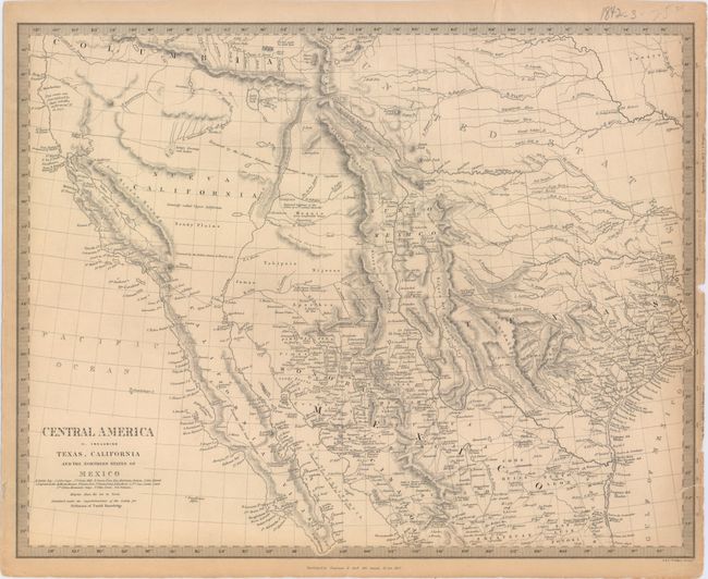
“Central America II. Including Texas, California and the Northern States of Mexico”
Map Maker:
SDUK Society for the Diffusion of Useful Knowledge
This excellent map covers the southwestern United ... (full text available to subscribers)
| Item Detail |
| |
| |
MapMaker: |
SDUK Society for the Diffusion of Useful Knowledge
|
|
| |
| |
Subject: |
Southwestern United States & Mexico, Texas |
|
| |
Period/Size: |
1842 / 12.2" x 15.5" (31.0 x 39.4 cm)
|
|
| |
Color: |
Black & White
|
|
| |
Condition: |
(B+) A nice crisp impression with toning along edges of sheet and two tiny edge tears that extend 0.25" and 0.5" into the image that have been closed on verso with archival tape. Narrow right margin with slightly trimmed distance scales and one small chi (condition help) |
|
| |
Source: |
|
|
| |
References: |
Wheat (TMW) #460. |
|
| |
|
|
| Sales Information |
| |
| |
Price: |
|
|
| |
| |
Offered by: |
Old World Auctions |
|
| |
Catalog: |
Auction No. 152 - Antique Maps, Charts, Atlases & Globes (9261) |
|
| |
Lot/Item #: |
289 |
|
| |
| |
Date: |
02/2015
|
|
| |
| |
|
Antique Maps - Valuation and Pricing, Descriptions, Resources |
|
Home |
Information |
Search |
Register |
Contact Us |
Site Map
Americana Exchange, Inc. © 1999 - 2024 Americana Exchange, Inc.. All rights reserved.
OldMaps.com, the OldMaps.com logo and
AMPR are service marks or registered service marks of Americana Exchange, Inc..
|