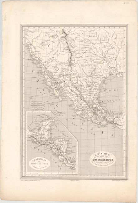
Title:
“Republique des Etats Unis du Mexique”
Map Maker:
Charles V. Monin
This map depicts Mexico extending north to the 42n... (full text available to subscribers)
| Item Detail |
| |
| |
MapMaker: |
Charles V. Monin
|
|
| |
| |
Subject: |
Southwestern United States & Mexico |
|
| |
Period/Size: |
1825 / 17.9" x 12.6" (45.5 x 32.0 cm)
|
|
| |
Color: |
Black & White
|
|
| |
Condition: |
(A) On a clean sheet with an edge tear at bottom confined to the blank margin. (condition help) |
|
| |
Source: |
|
|
| |
References: |
|
|
| |
|
|
| Sales Information |
| |
| |
Price: |
|
|
| |
| |
Offered by: |
Old World Auctions |
|
| |
Catalog: |
Auction No. 152 - Antique Maps, Charts, Atlases & Globes (9261) |
|
| |
Lot/Item #: |
285 |
|
| |
| |
Date: |
02/2015
|
|
| |
| |
|
Antique Maps - Valuation and Pricing, Descriptions, Resources |
|
Home |
Information |
Search |
Register |
Contact Us |
Site Map
Americana Exchange, Inc. © 1999 - 2024 Americana Exchange, Inc.. All rights reserved.
OldMaps.com, the OldMaps.com logo and
AMPR are service marks or registered service marks of Americana Exchange, Inc..
|