| Item Detail |
| |
| |
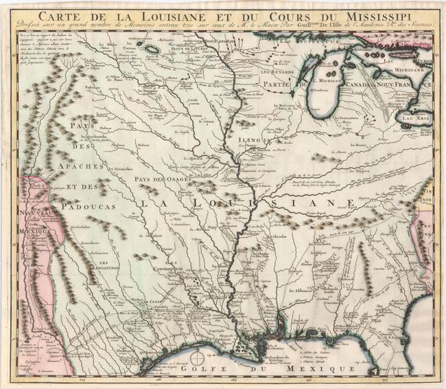
MapMaker: |
Guillaume Delisle
|
|
| |
| |
Subject: |
Colonial Central & Southern United States |
|
| |
Period/Size: |
1727 / 14.0" x 16.2" (35.6 x 41.2 cm)
|
|
| |
Color: |
Colored
|
|
| |
Condition: |
(A) Issued folding, now pressed on watermarked paper. A fine impression with attractive color. Expertly remargined at bottom with a minor amount of neatline in facsimile, and a binding trim at left has also been expertly replaced. Narrow right margin. (condition help) |
|
| |
Source: |
Histoire des Incas ģ Histoire de la Conquete de la Floride |
|
| |
References: |
Cumming (SE) #175; Tooley (Amer) p.22, #44; cf. Wheat (TMW) #99; cf. Martin & Martin #19. |
|
| |
|
|
| Sales Information |
| |
| |
Price: |
|
|
| |
| |
Offered by: |
Old World Auctions |
|
| |
Catalog: |
Auction No. 152 - Antique Maps, Charts, Atlases & Globes (9261) |
|
| |
Lot/Item #: |
173 |
|
| |
| |
Date: |
02/2015
|
|
| |
| |
|