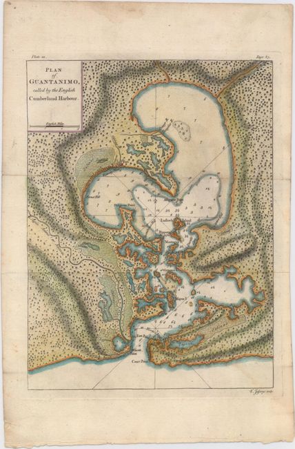
Title:
“Plan of Guantanimo, Called by the English Cumberland Harbour”
Map Maker:
Thomas Jefferys
In 1741, during the War of Jenkins' Ear, British A... (full text available to subscribers)
| Item Detail |
| |
| |
MapMaker: |
Thomas Jefferys
|
|
| |
| |
Subject: |
Guantanamo Bay, Cuba |
|
| |
Period/Size: |
1762 / 10.3" x 7.8" (26.2 x 19.9 cm)
|
|
| |
Color: |
Colored
|
|
| |
Condition: |
(B+) Issued folding, now pressed, on watermarked paper with a faint damp stain at right. (condition help) |
|
| |
Source: |
A Description of the Spanish Islands ... on the Coast of the West Indies |
|
| |
References: |
Shirley (BL Atlases) M.JEF-3a #22; cf. Cueto #294. |
|
| |
|
|
| Sales Information |
| |
| |
Price: |
|
|
| |
| |
Offered by: |
Old World Auctions |
|
| |
Catalog: |
Auction No. 152 - Antique Maps, Charts, Atlases & Globes (9261) |
|
| |
Lot/Item #: |
328 |
|
| |
| |
Date: |
02/2015
|
|
| |
| |
|
Antique Maps - Valuation and Pricing, Descriptions, Resources |
|
Home |
Information |
Search |
Register |
Contact Us |
Site Map
Americana Exchange, Inc. © 1999 - 2024 Americana Exchange, Inc.. All rights reserved.
OldMaps.com, the OldMaps.com logo and
AMPR are service marks or registered service marks of Americana Exchange, Inc..
|