| Item Detail |
| |
| |
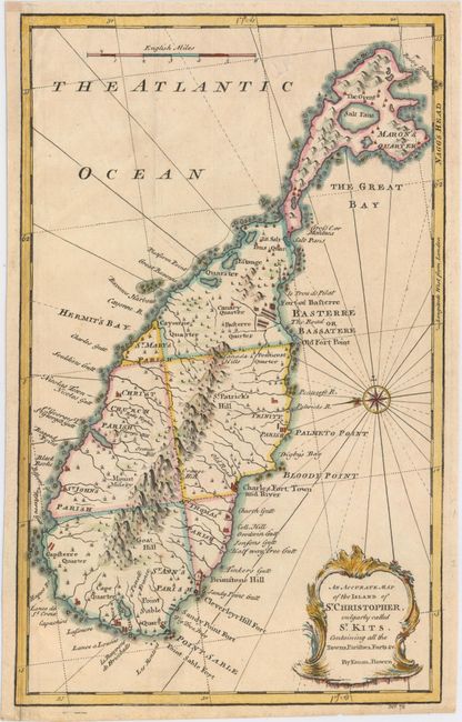
MapMaker: |
Emanuel Bowen
|
|
| |
| |
Subject: |
St. Kitts |
|
| |
Period/Size: |
1747 / 13.9" x 8.7" (35.3 x 22.1 cm)
|
|
| |
Color: |
Colored
|
|
| |
Condition: |
(B+) A nice impression with a short, archivally repaired tear at top, minor manuscript notations in borders, and a soft extraneous crease. Remargined at left with a small portion of neatline replaced in facsimile. (condition help) |
|
| |
Source: |
A Complete System of Geography… |
|
| |
References: |
Shirley (BL Atlases) T.BOW-2a #64. |
|
| |
|
|
| Sales Information |
| |
| |
Price: |
|
|
| |
| |
Offered by: |
Old World Auctions |
|
| |
Catalog: |
Auction No. 152 - Antique Maps, Charts, Atlases & Globes (9261) |
|
| |
Lot/Item #: |
337 |
|
| |
| |
Date: |
02/2015
|
|
| |
| |
|