| Item Detail |
| |
| |
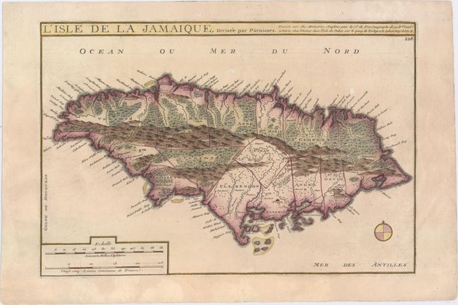
MapMaker: |
Nicolas de Fer
|
|
| |
| |
Subject: |
Jamaica |
|
| |
Period/Size: |
1714 / 9.2" x 13.6" (23.4 x 34.6 cm)
|
|
| |
Color: |
Colored
|
|
| |
Condition: |
(B+) There is very light soiling and several professionally repaired tears in bottom blank margin, one of which just enters neatline. (condition help) |
|
| |
Source: |
Suite de l'Atlas Curieux |
|
| |
References: |
Kapp (MCC-42) #52; Pastoureau, FER 1C [222]. |
|
| |
|
|
| Sales Information |
| |
| |
Price: |
|
|
| |
| |
Offered by: |
Old World Auctions |
|
| |
Catalog: |
Auction No. 152 - Antique Maps, Charts, Atlases & Globes (9261) |
|
| |
Lot/Item #: |
329 |
|
| |
| |
Date: |
02/2015
|
|
| |
| |
|