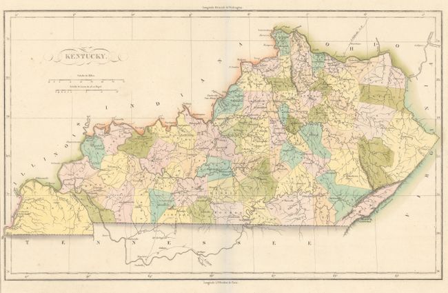
Title:
“Carte Geographique, Statistique et Historique du Kentucky”
Map Maker:
Jean Alexandre Buchon
This attractive copper engraved map details counti... (full text available to subscribers)
| Item Detail |
| |
| |
MapMaker: |
Jean Alexandre Buchon
|
|
| |
| |
Subject: |
Kentucky |
|
| |
Period/Size: |
1825 / 11.0" x 18.0" (28.0 x 45.8 cm)
|
|
| |
Color: |
Colored
|
|
| |
Condition: |
(A) Attractive original color on a very sturdy sheet with just a few faint spots and light soiling along the edges of the sheet. (condition help) |
|
| |
Source: |
Atlas Geographique...des Deux Ameriques |
|
| |
References: |
|
|
| |
|
|
| Sales Information |
| |
| |
Price: |
|
|
| |
| |
Offered by: |
Old World Auctions |
|
| |
Catalog: |
Auction No. 152 - Antique Maps, Charts, Atlases & Globes (9261) |
|
| |
Lot/Item #: |
214 |
|
| |
| |
Date: |
02/2015
|
|
| |
| |
|
Antique Maps - Valuation and Pricing, Descriptions, Resources |
|
Home |
Information |
Search |
Register |
Contact Us |
Site Map
Americana Exchange, Inc. © 1999 - 2024 Americana Exchange, Inc.. All rights reserved.
OldMaps.com, the OldMaps.com logo and
AMPR are service marks or registered service marks of Americana Exchange, Inc..
|