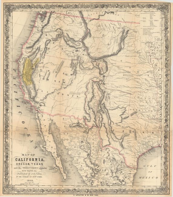
Title:
“Map of California, Oregon, Texas, and the Territories Adjoining with Routes &c.”
Map Maker:
Joseph Hutchins Colton
This map was issued to meet the huge demand for in... (full text available to subscribers)
| Item Detail |
| |
| |
MapMaker: |
Joseph Hutchins Colton
|
|
| |
| |
Subject: |
Western United States & Mexico |
|
| |
Period/Size: |
1849 / 20.8" x 18.1" (52.9 x 46.0 cm)
|
|
| |
Color: |
Colored
|
|
| |
Condition: |
(B+) Light toning along the folds, a few tiny splits at fold intersections, one small hole in the right border, and light staining in the border at bottom right. (condition help) |
|
| |
Source: |
|
|
| |
References: |
Wheat (TMW) #593; Wheat (Gold) #73; Howes #T223. |
|
| |
|
|
| Sales Information |
| |
| |
Price: |
|
|
| |
| |
Offered by: |
Old World Auctions |
|
| |
Catalog: |
Auction No. 152 - Antique Maps, Charts, Atlases & Globes (9261) |
|
| |
Lot/Item #: |
293 |
|
| |
| |
Date: |
02/2015
|
|
| |
| |
|
Antique Maps - Valuation and Pricing, Descriptions, Resources |
|
Home |
Information |
Search |
Register |
Contact Us |
Site Map
Americana Exchange, Inc. © 1999 - 2024 Americana Exchange, Inc.. All rights reserved.
OldMaps.com, the OldMaps.com logo and
AMPR are service marks or registered service marks of Americana Exchange, Inc..
|