Title:
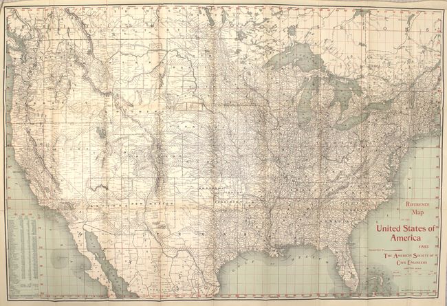
“Reference Map of the United States of America 1893 Presented by the American Society of Civil Engineers”
Map Maker:
Rand, McNally & Co.
Very detailed and finely printed map with red over... (full text available to subscribers)
| Item Detail |
| |
| |
MapMaker: |
Rand, McNally & Co.
|
|
| |
| |
Subject: |
United States |
|
| |
Period/Size: |
1893 / 20.5" x 30.5" (52.1 x 77.5 cm)
|
|
| |
Color: |
Colored
|
|
| |
Condition: |
(A) Map is clean and bright and in near fine condition with just a couple of tiny fold separations closed on verso with archival tape. Covers have minor soil. (condition help) |
|
| |
Source: |
|
|
| |
References: |
|
|
| |
|
|
| Sales Information |
| |
| |
Price: |
|
|
| |
| |
Offered by: |
Old World Auctions |
|
| |
Catalog: |
Auction No. 152 - Antique Maps, Charts, Atlases & Globes (9261) |
|
| |
Lot/Item #: |
137 |
|
| |
| |
Date: |
02/2015
|
|
| |
| |
|
Antique Maps - Valuation and Pricing, Descriptions, Resources |
|
Home |
Information |
Search |
Register |
Contact Us |
Site Map
Americana Exchange, Inc. © 1999 - 2024 Americana Exchange, Inc.. All rights reserved.
OldMaps.com, the OldMaps.com logo and
AMPR are service marks or registered service marks of Americana Exchange, Inc..
|