Title:
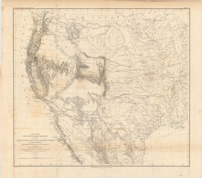
“Map of the United States and their Territories Between the Mississippi and the Pacific Ocean and Part of Mexico Compiled from Surveys…”
Map Maker:
William Hemsley Emory
This map is one of the foundation maps for the ... (full text available to subscribers)
| Item Detail |
| |
| |
MapMaker: |
William Hemsley Emory
|
|
| |
| |
Subject: |
Western United States & Mexico |
|
| |
Period/Size: |
1857-58 / 20.2" x 22.8" (51.3 x 58.0 cm)
|
|
| |
Color: |
Black & White
|
|
| |
Condition: |
(B+) Issued folding with light offsetting. (condition help) |
|
| |
Source: |
United States & Mexican Boundary Survey |
|
| |
References: |
Wheat (TMW) #916. |
|
| |
|
|
| Sales Information |
| |
| |
Price: |
|
|
| |
| |
Offered by: |
Old World Auctions |
|
| |
Catalog: |
Auction No. 152 - Antique Maps, Charts, Atlases & Globes (9261) |
|
| |
Lot/Item #: |
294 |
|
| |
| |
Date: |
02/2015
|
|
| |
| |
|
Antique Maps - Valuation and Pricing, Descriptions, Resources |
|
Home |
Information |
Search |
Register |
Contact Us |
Site Map
Americana Exchange, Inc. © 1999 - 2024 Americana Exchange, Inc.. All rights reserved.
OldMaps.com, the OldMaps.com logo and
AMPR are service marks or registered service marks of Americana Exchange, Inc..
|