Title:
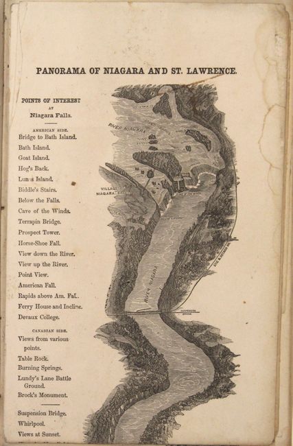
“The River St. Lawrence, in One Panoramic View, from Niagara Falls to Quebec, Together with Descriptions and Illustrations of the Thousand Islands, Cities in Canada...”
Map Maker:
Infrequent Publ. - Local & State Maps
This unusual guide book contains a strip map measu... (full text available to subscribers)
| Item Detail |
| |
| |
MapMaker: |
Infrequent Publ. - Local & State Maps
|
|
| |
| |
Subject: |
Eastern Canada, Niagara Falls |
|
| |
Period/Size: |
1859 / 9.5" x 6.0" (24.2 x 15.3 cm)
|
|
| |
Color: |
Black & White
|
|
| |
Condition: |
(B) Condition code is for the map which has several brown adhesive stains where the sheets were joined to form the strip map. Text and plates are very good with some minor staining and soiling. Binding is excellent. (condition help) |
|
| |
Source: |
|
|
| |
References: |
|
|
| |
|
|
| Sales Information |
| |
| |
Price: |
|
|
| |
| |
Offered by: |
Old World Auctions |
|
| |
Catalog: |
Auction No. 152 - Antique Maps, Charts, Atlases & Globes (9261) |
|
| |
Lot/Item #: |
104 |
|
| |
| |
Date: |
02/2015
|
|
| |
| |
|
Antique Maps - Valuation and Pricing, Descriptions, Resources |
|
Home |
Information |
Search |
Register |
Contact Us |
Site Map
Americana Exchange, Inc. © 1999 - 2024 Americana Exchange, Inc.. All rights reserved.
OldMaps.com, the OldMaps.com logo and
AMPR are service marks or registered service marks of Americana Exchange, Inc..
|