| Item Detail |
| |
| |
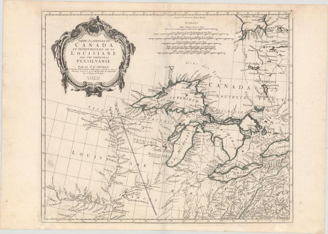
MapMaker: |
Anville/Santini
|
|
| |
| |
Subject: |
Colonial Central United States & Canada, Great Lakes |
|
| |
Period/Size: |
1775 / 19.1" x 22.5" (48.6 x 57.2 cm)
|
|
| |
Color: |
Colored
|
|
| |
Condition: |
(B+) A sharp impression and original outline color on a sturdy watermarked sheet with light damp stains at top and bottom and some printer's ink residue. (condition help) |
|
| |
Source: |
Atlas Universel... |
|
| |
References: |
Kershaw #977; Phillips (A) #647-46; Tooley (Amer) p. 317. |
|
| |
|
|
| Sales Information |
| |
| |
Price: |
|
|
| |
| |
Offered by: |
Old World Auctions |
|
| |
Catalog: |
Auction No. 152 - Antique Maps, Charts, Atlases & Globes (9261) |
|
| |
Lot/Item #: |
127 |
|
| |
| |
Date: |
02/2015
|
|
| |
| |
|