Title:
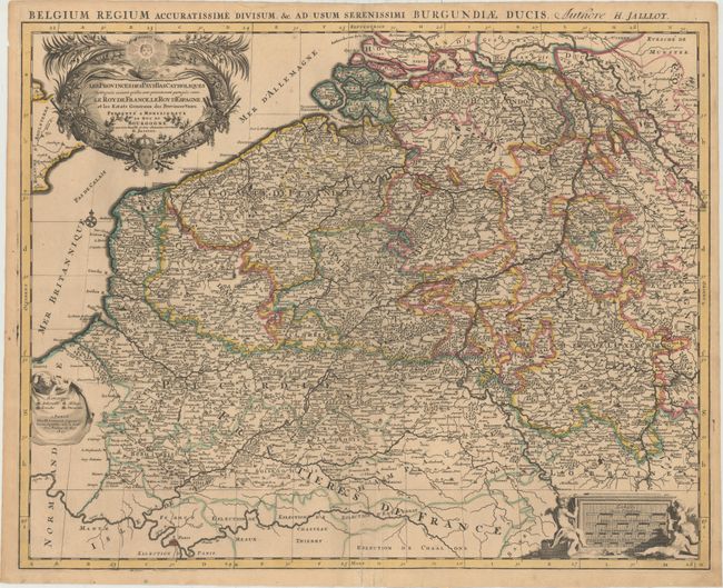
“Les Provinces des Pays-Bas Catholiques Distinguees Suivant Quelles sont Presentement Partagees Entre le Roy de France, le Roy d'Espagne, et les Estats Generaux des Provinces-Unies...”
Map Maker:
Jaillot/Mortier
This splendid, large map of the Low Countries cove... (full text available to subscribers)
| Item Detail |
| |
| |
MapMaker: |
Jaillot/Mortier
|
|
| |
| |
Subject: |
Western Europe |
|
| |
Period/Size: |
1693 / 19.1" x 24.3" (48.6 x 61.8 cm)
|
|
| |
Color: |
Colored
|
|
| |
Condition: |
(B+) Original outline color with light toning and a professionally repaired centerfold separation that enters 4" into image at bottom. (condition help) |
|
| |
Source: |
|
|
| |
References: |
|
|
| |
|
|
| Sales Information |
| |
| |
Price: |
|
|
| |
| |
Offered by: |
Old World Auctions |
|
| |
Catalog: |
Auction No. 152 - Antique Maps, Charts, Atlases & Globes (9261) |
|
| |
Lot/Item #: |
445 |
|
| |
| |
Date: |
02/2015
|
|
| |
| |
|
Antique Maps - Valuation and Pricing, Descriptions, Resources |
|
Home |
Information |
Search |
Register |
Contact Us |
Site Map
Americana Exchange, Inc. © 1999 - 2024 Americana Exchange, Inc.. All rights reserved.
OldMaps.com, the OldMaps.com logo and
AMPR are service marks or registered service marks of Americana Exchange, Inc..
|