Title:
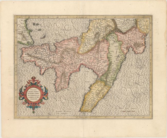
“Puglia Piana, Terra di Barri, Terra di Otranto, Calabria et Basilicata”
Map Maker:
Mercator/Hondius
This is a handsome map of the 'boot' of Italy show... (full text available to subscribers)
| Item Detail |
| |
| |
MapMaker: |
Mercator/Hondius
|
|
| |
| |
Subject: |
Southern Italy |
|
| |
Period/Size: |
1623 / 13.5" x 18.1" (34.3 x 46.0 cm)
|
|
| |
Color: |
Colored
|
|
| |
Condition: |
(B+) A clean, bright example with attractive color and a separation along a printer's crease that has been reinforced with archival material. (condition help) |
|
| |
Source: |
Gerardi Mercatoris Atlas sive Cosmographicae… |
|
| |
References: |
Van der Krogt (Vol. I) #7402:1. |
|
| |
|
|
| Sales Information |
| |
| |
Price: |
|
|
| |
| |
Offered by: |
Old World Auctions |
|
| |
Catalog: |
Auction No. 152 - Antique Maps, Charts, Atlases & Globes (9261) |
|
| |
Lot/Item #: |
543 |
|
| |
| |
Date: |
02/2015
|
|
| |
| |
|
Antique Maps - Valuation and Pricing, Descriptions, Resources |
|
Home |
Information |
Search |
Register |
Contact Us |
Site Map
Americana Exchange, Inc. © 1999 - 2024 Americana Exchange, Inc.. All rights reserved.
OldMaps.com, the OldMaps.com logo and
AMPR are service marks or registered service marks of Americana Exchange, Inc..
|