Title:
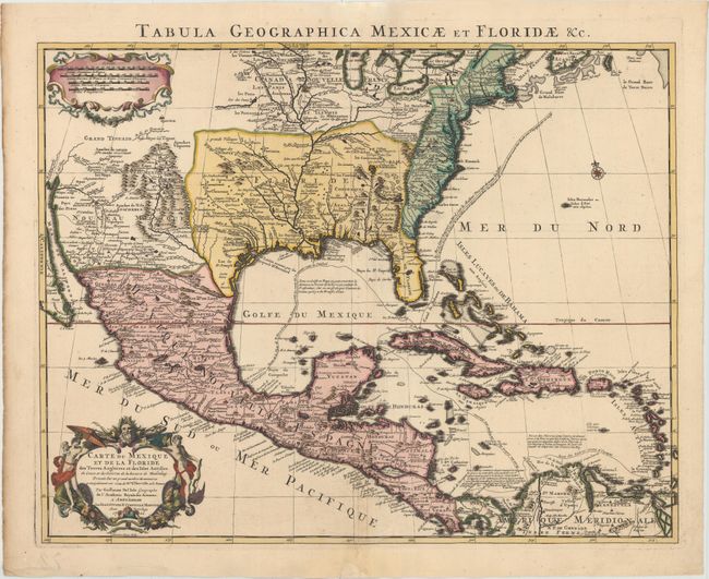
“Carte du Mexique et de la Floride des Terres Angloises et des Isles Antilles. Du Cours et des Environs de la Riviere de Mississipi...”
Map Maker:
Delisle/Covens & Mortier
Covens & Mortier's issue of Delisle's important ma... (full text available to subscribers)
| Item Detail |
| |
| |
MapMaker: |
Delisle/Covens & Mortier
|
|
| |
| |
Subject: |
Colonial North America & Caribbean |
|
| |
Period/Size: |
1722 / 18.6" x 23.8" (47.3 x 60.5 cm)
|
|
| |
Color: |
Colored
|
|
| |
Condition: |
(A) A dark impression with bold original color in the map and later coloring in the cartouches. There are professional repairs to a centerfold separation that enters 2.5" into map at bottom and a chip confined to bottom blank margin. Some minor creasing (condition help) |
|
| |
Source: |
|
|
| |
References: |
Tooley [Amer] #51; Schwartz & Ehrenberg Plt. 82; cf Cummings (SE) #137; Martin & Martin plt.17. |
|
| |
|
|
| Sales Information |
| |
| |
Price: |
|
|
| |
| |
Offered by: |
Old World Auctions |
|
| |
Catalog: |
Auction No. 152 - Antique Maps, Charts, Atlases & Globes (9261) |
|
| |
Lot/Item #: |
96 |
|
| |
| |
Date: |
02/2015
|
|
| |
| |
|
Antique Maps - Valuation and Pricing, Descriptions, Resources |
|
Home |
Information |
Search |
Register |
Contact Us |
Site Map
Americana Exchange, Inc. © 1999 - 2024 Americana Exchange, Inc.. All rights reserved.
OldMaps.com, the OldMaps.com logo and
AMPR are service marks or registered service marks of Americana Exchange, Inc..
|