Rister or Sign In to see pricing information


Title:

Map of the Cherokee Strip. Compiled from U.S. Surveys by E.W. Wiggins, C.E.

Map Maker:

U.S. State Surveys

Map of the Cherokee Strip. Compiled from U.S. Surveys by E.W. Wiggins, C.E.

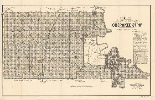
The Cherokee Outlet, about 12,000 square miles in ... (full text available to subscribers)
Item Detail
 
  MapMaker:  

U.S. State Surveys


  Subject:  Oklahoma  
  Period/Size:  1893 / 19.9" x 32.5"  (50.6 x 82.6 cm)  
  Color:  Black & White  
  Condition:  (A) A crisp impression, issued folding, now backed with archival tissue, with just a touch of soiling at bottom left. (condition help)  
  Source:  House Doc. #27, 53rd Congress, 1st Session  
  References:   
 
 
Sales Information
 
  Price: 

Please register your email to view records, or sign in with email address to see records


  Offered by:  Old World Auctions  
  Catalog:  Auction No. 152 - Antique Maps, Charts, Atlases & Globes (9261)  
  Lot/Item #:  244  
 
  Date:  02/2015  


Antique Maps - Valuation and Pricing, Descriptions, Resources


Home | Information | Search | Register | Contact Us | Site Map

Americana Exchange, Inc. © 1999 - 2024 Americana Exchange, Inc.. All rights reserved. OldMaps.com, the OldMaps.com logo and
AMPR are service marks or registered service marks of Americana Exchange, Inc..