| Item Detail |
| |
| |
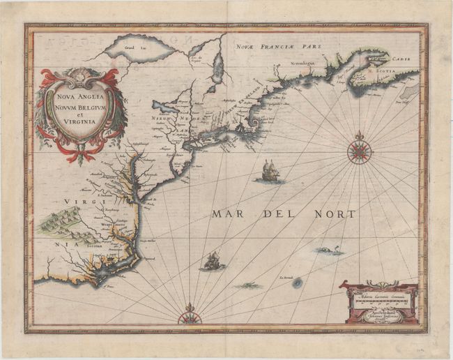
MapMaker: |
Jan Jansson
|
|
| |
| |
Subject: |
Colonial New England & Mid-Atlantic United States |
|
| |
Period/Size: |
1637 / 15.3" x 19.8" (38.9 x 50.3 cm)
|
|
| |
Color: |
Colored
|
|
| |
Condition: |
(B+) There is light offsetting and show-through of text on verso, and a few small abrasions with a minor amount of image replaced in facsimile. A tiny hole at top along centerfold and a 1" tear below the lower ship have been closed on verso with archival (condition help) |
|
| |
Source: |
Appendix Novi Atlantis |
|
| |
References: |
Burden #247; Cumming (SE) #39; Karpinski, p. 26 & 31 plt. II; McCorkle #636.2; Van der Krogt (Vol. I |
|
| |
|
|
| Sales Information |
| |
| |
Price: |
|
|
| |
| |
Offered by: |
Old World Auctions |
|
| |
Catalog: |
Auction No. 155 - Antique Maps, Charts, Atlases & Globes (9278) |
|
| |
Lot/Item #: |
152 |
|
| |
| |
Date: |
11/2015
|
|
| |
| |
|