| Item Detail |
| |
| |
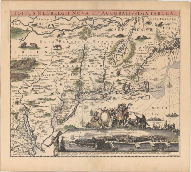
MapMaker: |
Carel Allard
|
|
| |
| |
Subject: |
Colonial New England & Mid-Atlantic United States |
|
| |
Period/Size: |
1680 / 18.3" x 21.3" (46.5 x 54.1 cm)
|
|
| |
Color: |
Colored
|
|
| |
Condition: |
(A) Excellent impression and color with wide margins. There are minute worm holes only visible when held to light, and expert repairs to several short centerfold separations and a couple of tiny tears perpendicular to the centerfold. The very edges of t (condition help) |
|
| |
Source: |
|
|
| |
References: |
Burden #373, state 4; Tooley (Amer) #17, pp. 287-89; Augustyn & Cohen pp. 46-47. |
|
| |
|
|
| Sales Information |
| |
| |
Price: |
|
|
| |
| |
Offered by: |
Old World Auctions |
|
| |
Catalog: |
Auction No. 155 - Antique Maps, Charts, Atlases & Globes (9278) |
|
| |
Lot/Item #: |
154 |
|
| |
| |
Date: |
11/2015
|
|
| |
| |
|