| Item Detail |
| |
| |
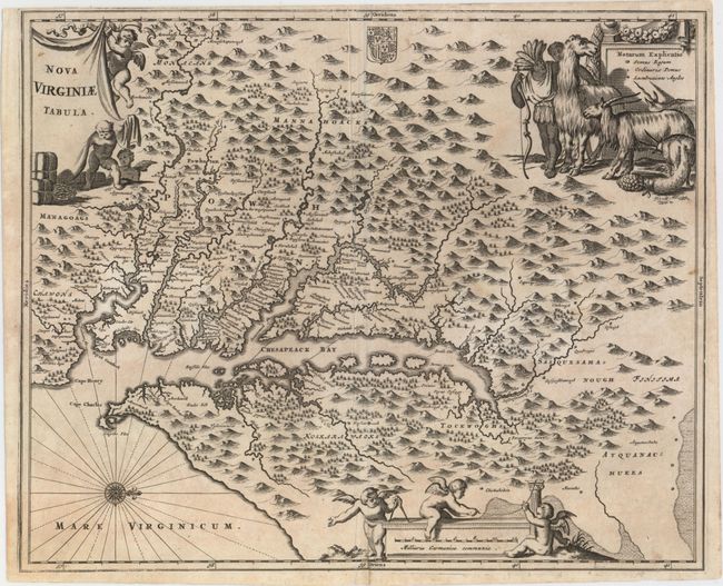
MapMaker: |
Montanus/Ogilby
|
|
| |
| |
Subject: |
Colonial Mid-Atlantic United States |
|
| |
Period/Size: |
1671 / 11.5" x 14.1" (29.3 x 35.9 cm)
|
|
| |
Color: |
Black & White
|
|
| |
Condition: |
(B+) A dark impression on watermarked paper with a printer's crease adjacent to centerfold, minor toning, a few unobtrusive spots, and a few short edge tears that have been closed with archival tape. There are remnants of hinge tape on verso. (condition help) |
|
| |
Source: |
America... |
|
| |
References: |
Burden #412; Tooley (Amer) p.168-9, plt. 76; Goss (NA) #38. |
|
| |
|
|
| Sales Information |
| |
| |
Price: |
|
|
| |
| |
Offered by: |
Old World Auctions |
|
| |
Catalog: |
Auction No. 155 - Antique Maps, Charts, Atlases & Globes (9278) |
|
| |
Lot/Item #: |
167 |
|
| |
| |
Date: |
11/2015
|
|
| |
| |
|