| Item Detail |
| |
| |
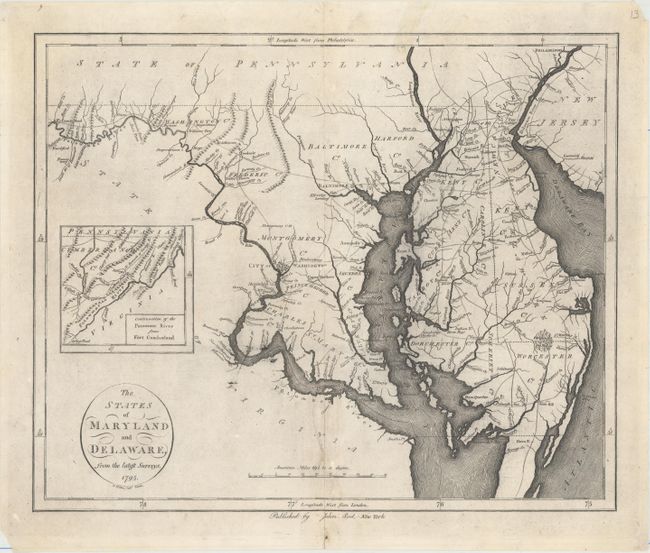
MapMaker: |
John Reid
|
|
| |
| |
Subject: |
Maryland & Delaware |
|
| |
Period/Size: |
1795 / 14.2" x 17.2" (36.1 x 43.7 cm)
|
|
| |
Color: |
Black & White
|
|
| |
Condition: |
(B+) On watermarked paper with a 3" tear near the centerfold at bottom that has been repaired with archival materials, minor soiling, and some printer's ink residue. There are some small holes in the blank margins, some of which have been backed in tissu (condition help) |
|
| |
Source: |
The American Atlas |
|
| |
References: |
Wheat & Brun #517. |
|
| |
|
|
| Sales Information |
| |
| |
Price: |
|
|
| |
| |
Offered by: |
Old World Auctions |
|
| |
Catalog: |
Auction No. 155 - Antique Maps, Charts, Atlases & Globes (9278) |
|
| |
Lot/Item #: |
179 |
|
| |
| |
Date: |
11/2015
|
|
| |
| |
|