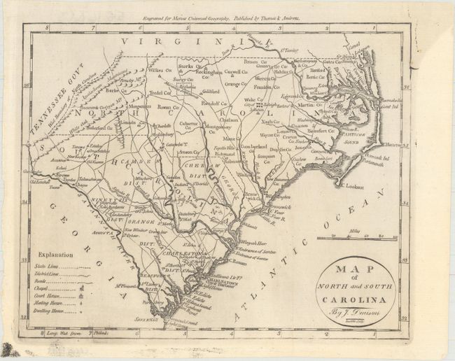
Title:
“Map of North and South Carolina”
Map Maker:
Jedidiah Morse
This small map of the Carolinas features a legend ... (full text available to subscribers)
| Item Detail |
| |
| |
MapMaker: |
Jedidiah Morse
|
|
| |
| |
Subject: |
North Carolina & South Carolina |
|
| |
Period/Size: |
1796 / 7.5" x 9.2" (19.1 x 23.4 cm)
|
|
| |
Color: |
Black & White
|
|
| |
Condition: |
(A) Issued folding with a short printer's crease at bottom and minor printer's ink residue. (condition help) |
|
| |
Source: |
The American Universal Geography |
|
| |
References: |
McCorkle (18th C. Geography) #304-14; Wheat & Brun #585. |
|
| |
|
|
| Sales Information |
| |
| |
Price: |
|
|
| |
| |
Offered by: |
Old World Auctions |
|
| |
Catalog: |
Auction No. 155 - Antique Maps, Charts, Atlases & Globes (9278) |
|
| |
Lot/Item #: |
189 |
|
| |
| |
Date: |
11/2015
|
|
| |
| |
|
Antique Maps - Valuation and Pricing, Descriptions, Resources |
|
Home |
Information |
Search |
Register |
Contact Us |
Site Map
Americana Exchange, Inc. © 1999 - 2024 Americana Exchange, Inc.. All rights reserved.
OldMaps.com, the OldMaps.com logo and
AMPR are service marks or registered service marks of Americana Exchange, Inc..
|