| Item Detail |
| |
| |
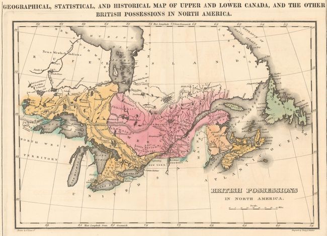
MapMaker: |
Carey & Lea
|
|
| |
| |
Subject: |
Canada |
|
| |
Period/Size: |
1822 / 9.8" x 14.2" (24.9 x 36.1 cm)
|
|
| |
Color: |
Colored
|
|
| |
Condition: |
(A) A dark impression on watermarked paper with original color. There is faint offsetting, short archivally repaired centerfold separations at top and bottom, and toning confined to the sheet's edges. (condition help) |
|
| |
Source: |
A Complete Historical, Chronological, and Geographical American Atlas... |
|
| |
References: |
|
|
| |
|
|
| Sales Information |
| |
| |
Price: |
|
|
| |
| |
Offered by: |
Old World Auctions |
|
| |
Catalog: |
Auction No. 153 - Antique Maps, Charts, Atlases & Globes (9276) |
|
| |
Lot/Item #: |
98 |
|
| |
| |
Date: |
05/2015
|
|
| |
| |
|