Title:
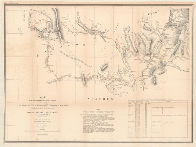
“Map of the Route Pursued in 1849 by the U.S. Troops, Under the Command of Bvt. Lieut. Col. Jno. M. Washington, Governor of New Mexico, in an Expedition Against the Navajos Indians”
Map Maker:
U.S. Government
This map is the product of a punitive expedition a... (full text available to subscribers)
| Item Detail |
| |
| |
MapMaker: |
U.S. Government
|
|
| |
| |
Subject: |
Southwestern United States |
|
| |
Period/Size: |
1849 / 20.0" x 27.5" (50.8 x 69.9 cm)
|
|
| |
Color: |
Colored
|
|
| |
Condition: |
(B) Issued folding and now flattened and backed with tissue to reinforce and repair a 2" tear near the center of the map and a 1.5" binding tear at left. Faint toning along the folds. (condition help) |
|
| |
Source: |
Navajo Journal, 31st Congress, 1st Session, Senate Exec. Doc. No.64 |
|
| |
References: |
Wheat (TMW) #641. |
|
| |
|
|
| Sales Information |
| |
| |
Price: |
|
|
| |
| |
Offered by: |
Old World Auctions |
|
| |
Catalog: |
Auction No. 153 - Antique Maps, Charts, Atlases & Globes (9276) |
|
| |
Lot/Item #: |
215 |
|
| |
| |
Date: |
05/2015
|
|
| |
| |
|
Antique Maps - Valuation and Pricing, Descriptions, Resources |
|
Home |
Information |
Search |
Register |
Contact Us |
Site Map
Americana Exchange, Inc. © 1999 - 2024 Americana Exchange, Inc.. All rights reserved.
OldMaps.com, the OldMaps.com logo and
AMPR are service marks or registered service marks of Americana Exchange, Inc..
|