Title:
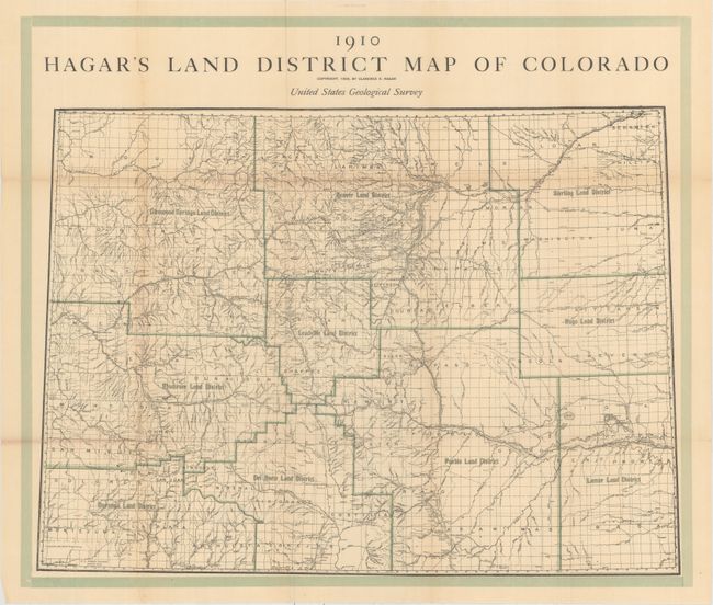
“1910 Hagar's Land District Map of Colorado”
Map Maker:
Clarence Edwin Hagar
This very detailed map of the state by Clarence Ha... (full text available to subscribers)
| Item Detail |
| |
| |
MapMaker: |
Clarence Edwin Hagar
|
|
| |
| |
Subject: |
Colorado |
|
| |
Period/Size: |
1910 / 18.0" x 21.3" (45.8 x 54.1 cm)
|
|
| |
Color: |
Colored
|
|
| |
Condition: |
(B+) Issued folding with a few short splits at fold intersections and light toning along the folds. (condition help) |
|
| |
Source: |
|
|
| |
References: |
|
|
| |
|
|
| Sales Information |
| |
| |
Price: |
|
|
| |
| |
Offered by: |
Old World Auctions |
|
| |
Catalog: |
Auction No. 153 - Antique Maps, Charts, Atlases & Globes (9276) |
|
| |
Lot/Item #: |
249 |
|
| |
| |
Date: |
05/2015
|
|
| |
| |
|
Antique Maps - Valuation and Pricing, Descriptions, Resources |
|
Home |
Information |
Search |
Register |
Contact Us |
Site Map
Americana Exchange, Inc. © 1999 - 2024 Americana Exchange, Inc.. All rights reserved.
OldMaps.com, the OldMaps.com logo and
AMPR are service marks or registered service marks of Americana Exchange, Inc..
|