Title:
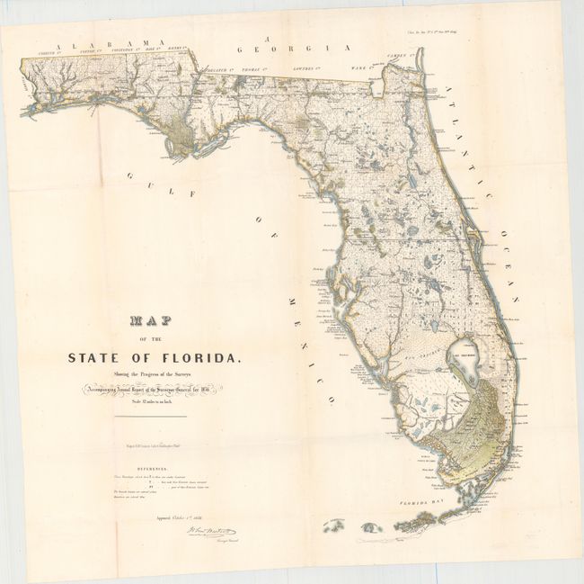
“Map of the State of Florida, Showing the Progress of the Surveys. Accompanying Annual Report of the Surveyor General for 1856”
Map Maker:
U.S. State Surveys
This is an early state survey map drawn on a scale... (full text available to subscribers)
| Item Detail |
| |
| |
MapMaker: |
U.S. State Surveys
|
|
| |
| |
Subject: |
Florida |
|
| |
Period/Size: |
1856 / 24.0" x 24.0" (61.0 x 61.0 cm)
|
|
| |
Color: |
Colored
|
|
| |
Condition: |
(B+) Issued folding with light toning along the folds and a few tiny edge tears not affecting the map. (condition help) |
|
| |
Source: |
Sen. Ex. Doc. No. 5 3rd Sess. 34th Cong. |
|
| |
References: |
|
|
| |
|
|
| Sales Information |
| |
| |
Price: |
|
|
| |
| |
Offered by: |
Old World Auctions |
|
| |
Catalog: |
Auction No. 153 - Antique Maps, Charts, Atlases & Globes (9276) |
|
| |
Lot/Item #: |
257 |
|
| |
| |
Date: |
05/2015
|
|
| |
| |
|
Antique Maps - Valuation and Pricing, Descriptions, Resources |
|
Home |
Information |
Search |
Register |
Contact Us |
Site Map
Americana Exchange, Inc. © 1999 - 2024 Americana Exchange, Inc.. All rights reserved.
OldMaps.com, the OldMaps.com logo and
AMPR are service marks or registered service marks of Americana Exchange, Inc..
|