| Item Detail |
| |
| |
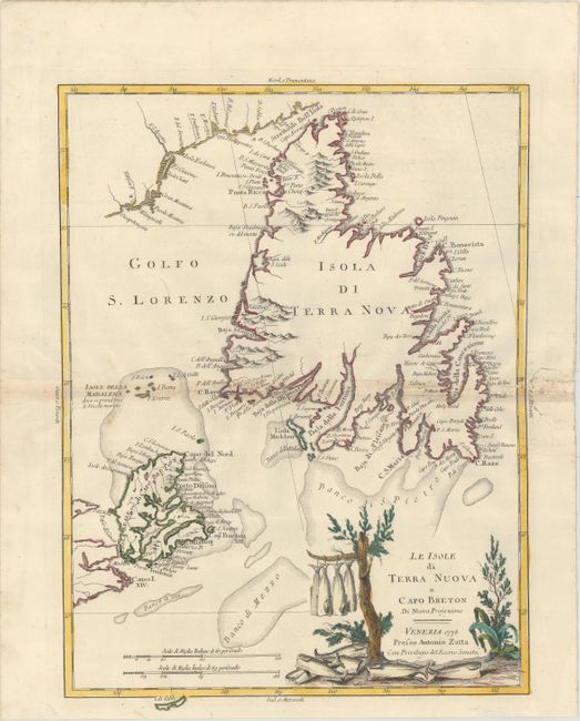
MapMaker: |
Antonio Zatta
|
|
| |
| |
Subject: |
Eastern Canada |
|
| |
Period/Size: |
1778 / 17.0" x 12.6" (43.2 x 32.0 cm)
|
|
| |
Color: |
Colored
|
|
| |
Condition: |
(B+) Original color on watermarked paper with light toning along centerfold and several very short tears along centerfold that have been archivally repaired. There are several worm tracks in right blank margin. (condition help) |
|
| |
Source: |
Atlante Novissimoģ |
|
| |
References: |
Kershaw #550; Shirley (BL Atlases) T.ZAT-1a Vol. 4 #41. |
|
| |
|
|
| Sales Information |
| |
| |
Price: |
|
|
| |
| |
Offered by: |
Old World Auctions |
|
| |
Catalog: |
Auction No. 153 - Antique Maps, Charts, Atlases & Globes (9276) |
|
| |
Lot/Item #: |
104 |
|
| |
| |
Date: |
05/2015
|
|
| |
| |
|