Title:
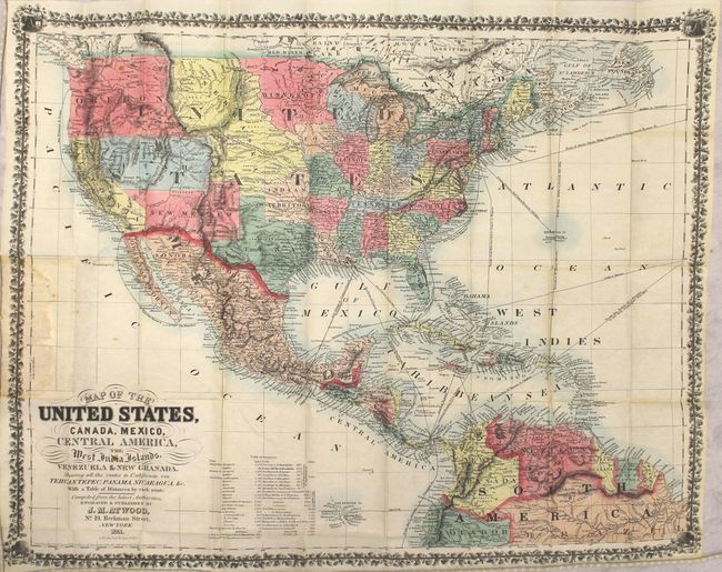
“Map of the United States, Canada, Mexico, Central America, the West India Islands, Venezuela & New Granada. Showing All the Routes to California via Tehuantepec, Panama, Nicaragua, &c.”
Map Maker:
John M. Atwood
This desirable gold rush map of the United States ... (full text available to subscribers)
| Item Detail |
| |
| |
MapMaker: |
John M. Atwood
|
|
| |
| |
Subject: |
United States & Mexico, Central America |
|
| |
Period/Size: |
1851 / 20.5" x 25.5" (52.1 x 64.8 cm)
|
|
| |
Color: |
Colored
|
|
| |
Condition: |
(B+) Issued folding in original color with a few spots of foxing, a couple of short splits at fold intersections, and minor staining where the map was glued to the board. Boards are very good with minor shelf wear. (condition help) |
|
| |
Source: |
|
|
| |
References: |
cf. Rumsey #2365. |
|
| |
|
|
| Sales Information |
| |
| |
Price: |
|
|
| |
| |
Offered by: |
Old World Auctions |
|
| |
Catalog: |
Auction No. 153 - Antique Maps, Charts, Atlases & Globes (9276) |
|
| |
Lot/Item #: |
337 |
|
| |
| |
Date: |
05/2015
|
|
| |
| |
|
Antique Maps - Valuation and Pricing, Descriptions, Resources |
|
Home |
Information |
Search |
Register |
Contact Us |
Site Map
Americana Exchange, Inc. © 1999 - 2024 Americana Exchange, Inc.. All rights reserved.
OldMaps.com, the OldMaps.com logo and
AMPR are service marks or registered service marks of Americana Exchange, Inc..
|