| Item Detail |
| |
| |
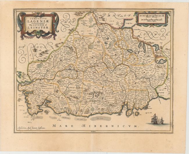
MapMaker: |
Jan Jansson
|
|
| |
| |
Subject: |
Eastern Ireland |
|
| |
Period/Size: |
1637 / 15.1" x 19.3" (38.4 x 49.1 cm)
|
|
| |
Color: |
Colored
|
|
| |
Condition: |
(B+) A nice impression with attractive color, light scattered foxing, and minor toning. There are archivally repaired centerfold separations in top and bottom blank margins. (condition help) |
|
| |
Source: |
Appendix Atlantis |
|
| |
References: |
Van der Krogt (Vol. I) #5910:1. |
|
| |
|
|
| Sales Information |
| |
| |
Price: |
|
|
| |
| |
Offered by: |
Old World Auctions |
|
| |
Catalog: |
Auction No. 153 - Antique Maps, Charts, Atlases & Globes (9276) |
|
| |
Lot/Item #: |
467 |
|
| |
| |
Date: |
05/2015
|
|
| |
| |
|