Title:
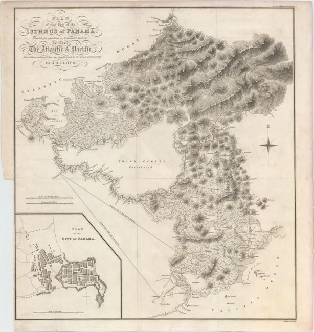
“Plan of That Part of the Isthmus of Panama, Eligible for Effecting a Communication Between the Atlantic & Pacific, from Observations & Surveys Performed in the Years 1828 & 1829”
Map Maker:
James Gardner
This detailed topographical map depicts the region... (full text available to subscribers)
| Item Detail |
| |
| |
MapMaker: |
James Gardner
|
|
| |
| |
Subject: |
Panama |
|
| |
Period/Size: |
1829 / 17.6" x 15.8" (44.7 x 40.2 cm)
|
|
| |
Color: |
Black & White
|
|
| |
Condition: |
(B+) A nice impression, issued folding with a few minor spots of foxing and light toning along edges of sheet. There is a binding trim at bottom left that extends to the neatline. (condition help) |
|
| |
Source: |
|
|
| |
References: |
|
|
| |
|
|
| Sales Information |
| |
| |
Price: |
|
|
| |
| |
Offered by: |
Old World Auctions |
|
| |
Catalog: |
Auction No. 153 - Antique Maps, Charts, Atlases & Globes (9276) |
|
| |
Lot/Item #: |
369 |
|
| |
| |
Date: |
05/2015
|
|
| |
| |
|
Antique Maps - Valuation and Pricing, Descriptions, Resources |
|
Home |
Information |
Search |
Register |
Contact Us |
Site Map
Americana Exchange, Inc. © 1999 - 2024 Americana Exchange, Inc.. All rights reserved.
OldMaps.com, the OldMaps.com logo and
AMPR are service marks or registered service marks of Americana Exchange, Inc..
|