| Item Detail |
| |
| |
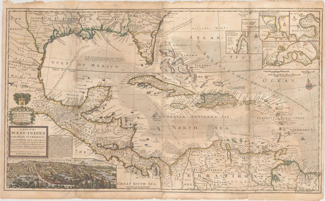
MapMaker: |
Herman Moll
|
|
| |
| |
Subject: |
Gulf of Mexico & Caribbean |
|
| |
Period/Size: |
1720 / 23.0" x 40.0" (58.5 x 101.6 cm)
|
|
| |
Color: |
Colored
|
|
| |
Condition: |
(C+) There is light toning along the folds, some soiling, and several damp stains at bottom. There are archival repairs to numerous fold separations, several short tears adjacent to the folds, and a 6" tear through the title cartouche. A small chip at t (condition help) |
|
| |
Source: |
|
|
| |
References: |
|
|
| |
|
|
| Sales Information |
| |
| |
Price: |
|
|
| |
| |
Offered by: |
Old World Auctions |
|
| |
Catalog: |
Auction No. 153 - Antique Maps, Charts, Atlases & Globes (9276) |
|
| |
Lot/Item #: |
375 |
|
| |
| |
Date: |
05/2015
|
|
| |
| |
|