| Item Detail |
| |
| |
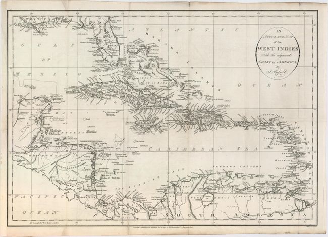
MapMaker: |
John Russell
|
|
| |
| |
Subject: |
Caribbean |
|
| |
Period/Size: |
1795 / 13.8" x 19.8" (35.1 x 50.3 cm)
|
|
| |
Color: |
Black & White
|
|
| |
Condition: |
(B+) Issued folding and now flattened with faint offsetting, minor soiling, and archival repairs to a 3" fold separation at bottom and a 4" binding tear at left. (condition help) |
|
| |
Source: |
Am American Atlas… |
|
| |
References: |
Phillips (Maps) p. 1059; Phillips (A) p. 751. |
|
| |
|
|
| Sales Information |
| |
| |
Price: |
|
|
| |
| |
Offered by: |
Old World Auctions |
|
| |
Catalog: |
Auction No. 153 - Antique Maps, Charts, Atlases & Globes (9276) |
|
| |
Lot/Item #: |
383 |
|
| |
| |
Date: |
05/2015
|
|
| |
| |
|