| Item Detail |
| |
| |
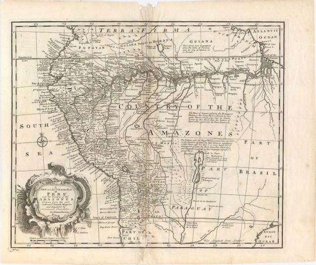
MapMaker: |
Emanuel Bowen
|
|
| |
| |
Subject: |
Central South America |
|
| |
Period/Size: |
1747 / 13.8" x 16.5" (35.1 x 42.0 cm)
|
|
| |
Color: |
Black & White
|
|
| |
Condition: |
(B+) A dark impression with light toning along the centerfold, several printer's creases at right, and a few faint spots of foxing. There are several worm holes in the top blank margin and at bottom entering 1" into map, with the bottom worm holes profes (condition help) |
|
| |
Source: |
A Complete System of Geography |
|
| |
References: |
Shirley (BL Atlases) T.BOW-2A #55. |
|
| |
|
|
| Sales Information |
| |
| |
Price: |
|
|
| |
| |
Offered by: |
Old World Auctions |
|
| |
Catalog: |
Auction No. 153 - Antique Maps, Charts, Atlases & Globes (9276) |
|
| |
Lot/Item #: |
425 |
|
| |
| |
Date: |
05/2015
|
|
| |
| |
|