| Item Detail |
| |
| |
MapMaker: |
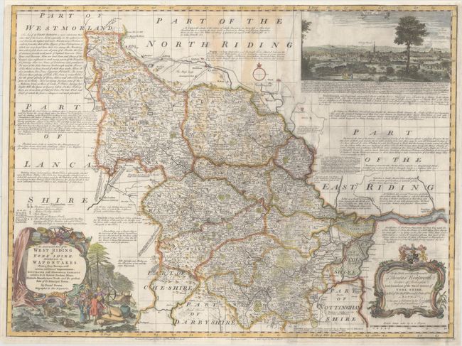
Emanuel Bowen
|
|
| |
| |
Subject: |
Northern England |
|
| |
Period/Size: |
1752 / 20.9" x 27.9" (53.1 x 70.9 cm)
|
|
| |
Color: |
Colored
|
|
| |
Condition: |
(B) A slightly uneven impression with light staining, some printer's ink residue, and two tears (1.5" - 2") near the center of the map that have been closed on verso with old paper. Remargined at top with a portion of the neatline in facsimile. (condition help) |
|
| |
Source: |
|
|
| |
References: |
|
|
| |
|
|
| Sales Information |
| |
| |
Price: |
|
|
| |
| |
Offered by: |
Old World Auctions |
|
| |
Catalog: |
Auction No. 153 - Antique Maps, Charts, Atlases & Globes (9276) |
|
| |
Lot/Item #: |
453 |
|
| |
| |
Date: |
05/2015
|
|
| |
| |
|