Title:
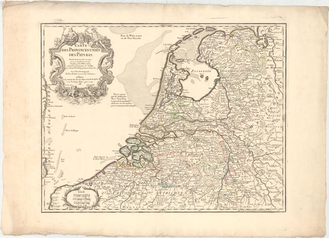
“Carte des Provinces Unies des Pays Bas. Tiree des Cartes les Plus Correctea...”
Map Maker:
Delisle/Dezauche
An interesting later issue of Delisle's map of the... (full text available to subscribers)
| Item Detail |
| |
| |
MapMaker: |
Delisle/Dezauche
|
|
| |
| |
Subject: |
Low Countries |
|
| |
Period/Size: |
1788 / 18.6" x 24.2" (47.3 x 61.5 cm)
|
|
| |
Color: |
Colored
|
|
| |
Condition: |
(B+) A nice impression with original outline color on watermarked paper with one tiny hole in the North Sea. Minor soiling in the blank margins. The sheet has deckled edges. (condition help) |
|
| |
Source: |
|
|
| |
References: |
|
|
| |
|
|
| Sales Information |
| |
| |
Price: |
|
|
| |
| |
Offered by: |
Old World Auctions |
|
| |
Catalog: |
Auction No. 153 - Antique Maps, Charts, Atlases & Globes (9276) |
|
| |
Lot/Item #: |
481 |
|
| |
| |
Date: |
05/2015
|
|
| |
| |
|
Antique Maps - Valuation and Pricing, Descriptions, Resources |
|
Home |
Information |
Search |
Register |
Contact Us |
Site Map
Americana Exchange, Inc. © 1999 - 2024 Americana Exchange, Inc.. All rights reserved.
OldMaps.com, the OldMaps.com logo and
AMPR are service marks or registered service marks of Americana Exchange, Inc..
|