| Item Detail |
| |
| |
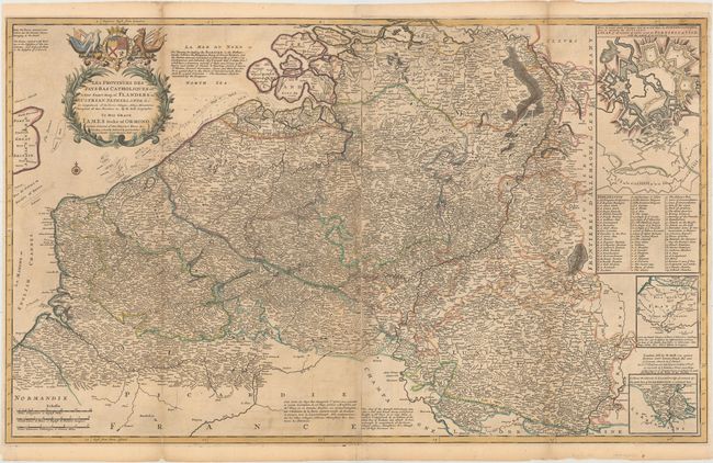
MapMaker: |
Herman Moll
|
|
| |
| |
Subject: |
Belgium & Luxembourg |
|
| |
Period/Size: |
1730 / 24.3" x 39.9" (61.8 x 101.4 cm)
|
|
| |
Color: |
Colored
|
|
| |
Condition: |
(B) A nice impression with light toning along the folds, light offsetting, and minor soiling. There are some long fold separations and tears that have been repaired with archival materials. (condition help) |
|
| |
Source: |
The World Described; or, A New and Correct Sett of Maps |
|
| |
References: |
Shirley (BL Atlases) T.MOLL-4b #22. |
|
| |
|
|
| Sales Information |
| |
| |
Price: |
|
|
| |
| |
Offered by: |
Old World Auctions |
|
| |
Catalog: |
Auction No. 153 - Antique Maps, Charts, Atlases & Globes (9276) |
|
| |
Lot/Item #: |
482 |
|
| |
| |
Date: |
05/2015
|
|
| |
| |
|