| Item Detail |
| |
| |
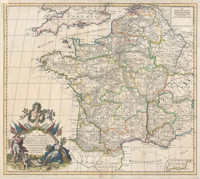
MapMaker: |
John Senex
|
|
| |
| |
Subject: |
France |
|
| |
Period/Size: |
1719 / 20.1" x 22.6" (51.1 x 57.4 cm)
|
|
| |
Color: |
Colored
|
|
| |
Condition: |
(B) A fine impression on watermarked paper with minor soiling and a number of small tears at top and bottom, some entering the map 1/2" to 2", and the majority of which have been archivally repaired. A chip at top left has also been repaired with a small (condition help) |
|
| |
Source: |
A New General Atlas |
|
| |
References: |
Shirley (BL Atlases) T.SEN-2a #11. |
|
| |
|
|
| Sales Information |
| |
| |
Price: |
|
|
| |
| |
Offered by: |
Old World Auctions |
|
| |
Catalog: |
Auction No. 153 - Antique Maps, Charts, Atlases & Globes (9276) |
|
| |
Lot/Item #: |
489 |
|
| |
| |
Date: |
05/2015
|
|
| |
| |
|