Title:
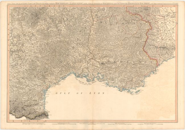
“The South Eastern Part of France Which Includes Roussillon-Languedoc, with a Great Portion of Rouergue and Auvergne-Provence-Dauphine, and the Whole Frontier of Italy”
Map Maker:
William Faden
This map of southeastern France spans from the Spa... (full text available to subscribers)
| Item Detail |
| |
| |
MapMaker: |
William Faden
|
|
| |
| |
Subject: |
Southeastern France |
|
| |
Period/Size: |
1799 / 21.1" x 30.6" (53.6 x 77.8 cm)
|
|
| |
Color: |
Colored
|
|
| |
Condition: |
(B+) Original outline color with light offsetting and a few tiny marginal tears. (condition help) |
|
| |
Source: |
|
|
| |
References: |
Shirley (BL Atlases) T.FAD-4a #16. |
|
| |
|
|
| Sales Information |
| |
| |
Price: |
|
|
| |
| |
Offered by: |
Old World Auctions |
|
| |
Catalog: |
Auction No. 153 - Antique Maps, Charts, Atlases & Globes (9276) |
|
| |
Lot/Item #: |
498 |
|
| |
| |
Date: |
05/2015
|
|
| |
| |
|
Antique Maps - Valuation and Pricing, Descriptions, Resources |
|
Home |
Information |
Search |
Register |
Contact Us |
Site Map
Americana Exchange, Inc. © 1999 - 2024 Americana Exchange, Inc.. All rights reserved.
OldMaps.com, the OldMaps.com logo and
AMPR are service marks or registered service marks of Americana Exchange, Inc..
|