Title:
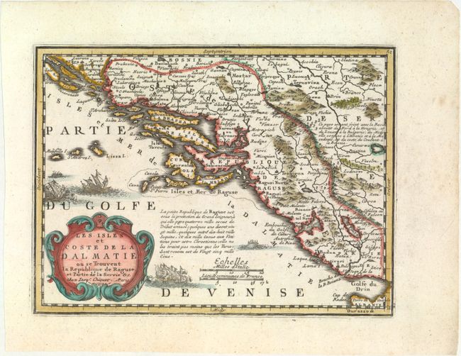
“Les Isles et Coste de la Dalmatie. Ou se Trouvent la Republique de Raguse, et Partie de la Servie &c.”
Map Maker:
Jacques Chiquet
This map depicts the western coastline of the Balk... (full text available to subscribers)
| Item Detail |
| |
| |
MapMaker: |
Jacques Chiquet
|
|
| |
| |
Subject: |
Western Balkans |
|
| |
Period/Size: |
1719 / 6.6" x 8.8" (16.8 x 22.4 cm)
|
|
| |
Color: |
Colored
|
|
| |
Condition: |
(A+) A clean, bright example with original color with minor refreshing. (condition help) |
|
| |
Source: |
Le Nouveau et Curieux Atlas Geographique et Historique |
|
| |
References: |
Mickwitz & Miekkavaara #43-22. |
|
| |
|
|
| Sales Information |
| |
| |
Price: |
|
|
| |
| |
Offered by: |
Old World Auctions |
|
| |
Catalog: |
Auction No. 153 - Antique Maps, Charts, Atlases & Globes (9276) |
|
| |
Lot/Item #: |
563 |
|
| |
| |
Date: |
05/2015
|
|
| |
| |
|
Antique Maps - Valuation and Pricing, Descriptions, Resources |
|
Home |
Information |
Search |
Register |
Contact Us |
Site Map
Americana Exchange, Inc. © 1999 - 2024 Americana Exchange, Inc.. All rights reserved.
OldMaps.com, the OldMaps.com logo and
AMPR are service marks or registered service marks of Americana Exchange, Inc..
|