Title:
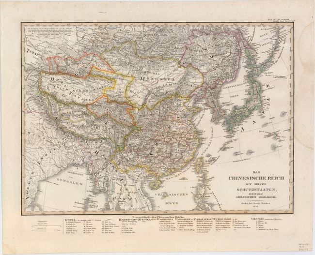
“Das Chinesische Reich mit Seinen Schutzstaaten, nebst dem Japanischen Inselreiche”
Map Maker:
Perthes [Family and Companies]
This intricately engraved map shows China, Tibet, ... (full text available to subscribers)
| Item Detail |
| |
| |
MapMaker: |
Perthes [Family and Companies]
|
|
| |
| |
Subject: |
Eastern Asia |
|
| |
Period/Size: |
1833 / 10.7" x 15.1" (27.2 x 38.4 cm)
|
|
| |
Color: |
Colored
|
|
| |
Condition: |
(A) Original outline color with a few faint spots and a damp stain that just enters into the neatline at right. (condition help) |
|
| |
Source: |
Stieler's Hand Atlas |
|
| |
References: |
|
|
| |
|
|
| Sales Information |
| |
| |
Price: |
|
|
| |
| |
Offered by: |
Old World Auctions |
|
| |
Catalog: |
Auction No. 153 - Antique Maps, Charts, Atlases & Globes (9276) |
|
| |
Lot/Item #: |
660 |
|
| |
| |
Date: |
05/2015
|
|
| |
| |
|
Antique Maps - Valuation and Pricing, Descriptions, Resources |
|
Home |
Information |
Search |
Register |
Contact Us |
Site Map
Americana Exchange, Inc. © 1999 - 2024 Americana Exchange, Inc.. All rights reserved.
OldMaps.com, the OldMaps.com logo and
AMPR are service marks or registered service marks of Americana Exchange, Inc..
|