| Item Detail |
| |
| |
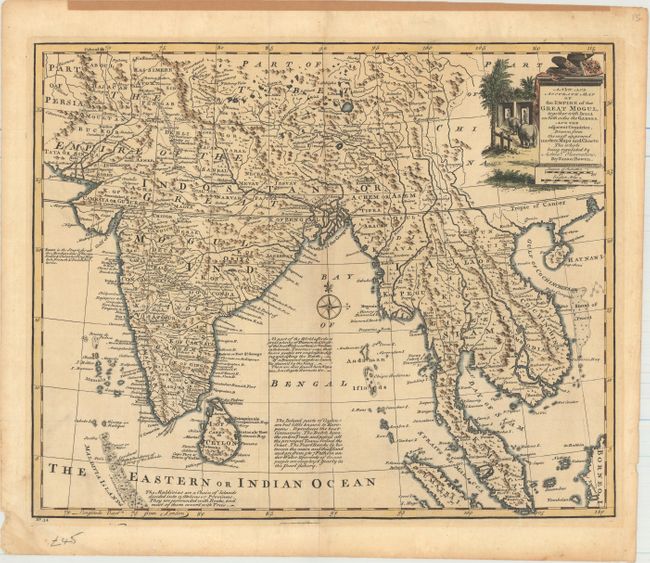
MapMaker: |
Emanuel Bowen
|
|
| |
| |
Subject: |
Southern Asia |
|
| |
Period/Size: |
1747 / 13.8" x 16.8" (35.1 x 42.7 cm)
|
|
| |
Color: |
Colored
|
|
| |
Condition: |
(B+) A crisp impression with attractive color and very light toning. There is a minor damp stain in the blank margin at bottom left, and several short tears confined to the blank margins. There is paper tape along the top edge of the sheet on recto, awa (condition help) |
|
| |
Source: |
A Complete System of Geography |
|
| |
References: |
Shirley (BL Atlases) T.BOW-1a #43. |
|
| |
|
|
| Sales Information |
| |
| |
Price: |
|
|
| |
| |
Offered by: |
Old World Auctions |
|
| |
Catalog: |
Auction No. 155 - Antique Maps, Charts, Atlases & Globes (9278) |
|
| |
Lot/Item #: |
658 |
|
| |
| |
Date: |
11/2015
|
|
| |
| |
|