Title:
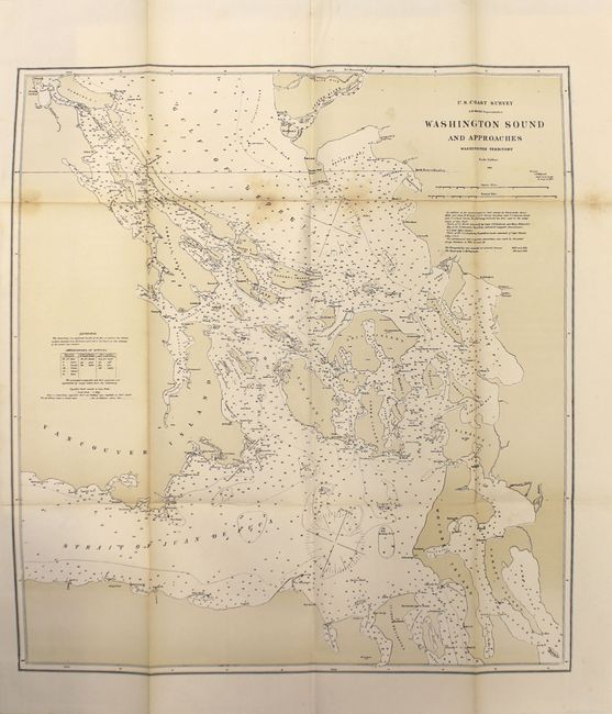
“I. Memorial on the Canal de Haro as the Boundary Line of the United States of America, Presented in the Name of the American Government to His Majesty William I…”
Map Maker:
U.S. Government
This important document related to the Treaty of 1... (full text available to subscribers)
| Item Detail |
| |
| |
MapMaker: |
U.S. Government
|
|
| |
| |
Subject: |
Canada & United States, Alaska |
|
| |
Period/Size: |
1872 / 9.1" x 5.9" (23.2 x 15.0 cm)
|
|
| |
Color: |
Colored
|
|
| |
Condition: |
(B+) Maps are very good to fine with some light staining along the upper fold of a few maps and very light toning along the folds. Text is clean and bright. (condition help) |
|
| |
Source: |
|
|
| |
References: |
|
|
| |
|
|
| Sales Information |
| |
| |
Price: |
|
|
| |
| |
Offered by: |
Old World Auctions |
|
| |
Catalog: |
Auction No. 154 - Antique Maps, Charts, Atlases & Globes (9277) |
|
| |
Lot/Item #: |
95 |
|
| |
| |
Date: |
09/2015
|
|
| |
| |
|
Antique Maps - Valuation and Pricing, Descriptions, Resources |
|
Home |
Information |
Search |
Register |
Contact Us |
Site Map
Americana Exchange, Inc. © 1999 - 2024 Americana Exchange, Inc.. All rights reserved.
OldMaps.com, the OldMaps.com logo and
AMPR are service marks or registered service marks of Americana Exchange, Inc..
|