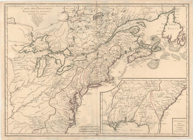
Title:
“Carte des Possessions Francoises et Angloises dans le Canada, et Partie de la Louisiane”
Map Maker:
Sebastian G. Longchamps
This is the first state of this separately publish... (full text available to subscribers)
| Item Detail |
| |
| |
MapMaker: |
Sebastian G. Longchamps
|
|
| |
| |
Subject: |
Colonial Eastern United States & Canada |
|
| |
Period/Size: |
1756 / 21.6" x 30.0" (54.9 x 76.2 cm)
|
|
| |
Color: |
Colored
|
|
| |
Condition: |
(B+) Original color on watermarked paper with very light soiling. There are archival repairs to several short separations along the centerfold and a few tiny holes in the image. There are some bluish shadows along the centerfold that are caused by our s (condition help) |
|
| |
Source: |
|
|
| |
References: |
Kershaw #358; McCorkle #756.9; Sellers & Van Ee #70. |
|
| |
|
|
| Sales Information |
| |
| |
Price: |
|
|
| |
| |
Offered by: |
Old World Auctions |
|
| |
Catalog: |
Auction No. 154 - Antique Maps, Charts, Atlases & Globes (9277) |
|
| |
Lot/Item #: |
98 |
|
| |
| |
Date: |
09/2015
|
|
| |
| |
|
Antique Maps - Valuation and Pricing, Descriptions, Resources |
|
Home |
Information |
Search |
Register |
Contact Us |
Site Map
Americana Exchange, Inc. © 1999 - 2024 Americana Exchange, Inc.. All rights reserved.
OldMaps.com, the OldMaps.com logo and
AMPR are service marks or registered service marks of Americana Exchange, Inc..
|