| Item Detail |
| |
| |
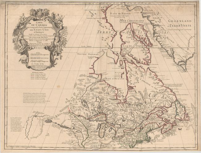
MapMaker: |
Delisle/Dezauche
|
|
| |
| |
Subject: |
Colonial Northeastern United States & Canada, Great Lakes |
|
| |
Period/Size: |
1783 / 19.9" x 25.8" (50.6 x 65.6 cm)
|
|
| |
Color: |
Colored
|
|
| |
Condition: |
(B+) A fine impression with original outline color on a watermarked sheet with light soiling and a tiny hole at bottom near the centerfold. Professionally remargined at top with a portion of border replaced in facsimile. (condition help) |
|
| |
Source: |
Atlas Geographique Des Quatre Parties Du Monde |
|
| |
References: |
Kershaw # 315; Tooley (Amer) #42, p. 21. |
|
| |
|
|
| Sales Information |
| |
| |
Price: |
|
|
| |
| |
Offered by: |
Old World Auctions |
|
| |
Catalog: |
Auction No. 154 - Antique Maps, Charts, Atlases & Globes (9277) |
|
| |
Lot/Item #: |
109 |
|
| |
| |
Date: |
09/2015
|
|
| |
| |
|