Title:
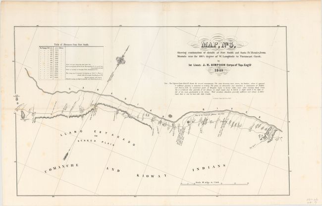
“Map, No 3, Showing Continuation of Details of Fort Smith and Santa Fe Route, from Mounds Near the 100 1/2 Degree of W. Longitude to Tucumcari Creek”
Map Maker:
James Hervey Simpson
This is the third sheet of a four sheet map that d... (full text available to subscribers)
| Item Detail |
| |
| |
MapMaker: |
James Hervey Simpson
|
|
| |
| |
Subject: |
Oklahoma, Texas |
|
| |
Period/Size: |
1849 / 12.4" x 20.2" (31.5 x 51.3 cm)
|
|
| |
Color: |
Black & White
|
|
| |
Condition: |
(B+) Issued folding with very light scattered foxing mostly along the left side of the sheet. (condition help) |
|
| |
Source: |
Sen. Ex. Doc. 12, 31st Cong., 1st Sess. |
|
| |
References: |
Wheat (TMW) #640. |
|
| |
|
|
| Sales Information |
| |
| |
Price: |
|
|
| |
| |
Offered by: |
Old World Auctions |
|
| |
Catalog: |
Auction No. 154 - Antique Maps, Charts, Atlases & Globes (9277) |
|
| |
Lot/Item #: |
170 |
|
| |
| |
Date: |
09/2015
|
|
| |
| |
|
Antique Maps - Valuation and Pricing, Descriptions, Resources |
|
Home |
Information |
Search |
Register |
Contact Us |
Site Map
Americana Exchange, Inc. © 1999 - 2024 Americana Exchange, Inc.. All rights reserved.
OldMaps.com, the OldMaps.com logo and
AMPR are service marks or registered service marks of Americana Exchange, Inc..
|