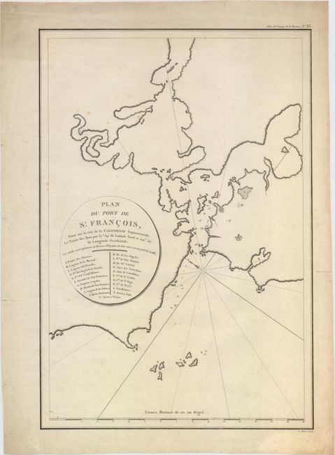
Title:
“Plan du Port de St. Francois, Situe sur la Cote de la Californie Septentrionale...”
Map Maker:
Jean Francois Galaup de La Perouse
This uncommon chart is one of the earliest obtaina... (full text available to subscribers)
| Item Detail |
| |
| |
MapMaker: |
Jean Francois Galaup de La Perouse
|
|
| |
| |
Subject: |
San Francisco, California |
|
| |
Period/Size: |
1797 / 19.4" x 13.3" (49.3 x 33.8 cm)
|
|
| |
Color: |
Black & White
|
|
| |
Condition: |
(B+) A nice impression with light soiling and few spots of foxing. (condition help) |
|
| |
Source: |
Atlas du Voyage de La Perouse... |
|
| |
References: |
Wagner (NW) #846; Shirley (BL Atlases) G.LPR-1a #33. |
|
| |
|
|
| Sales Information |
| |
| |
Price: |
|
|
| |
| |
Offered by: |
Old World Auctions |
|
| |
Catalog: |
Auction No. 154 - Antique Maps, Charts, Atlases & Globes (9277) |
|
| |
Lot/Item #: |
190 |
|
| |
| |
Date: |
09/2015
|
|
| |
| |
|
Antique Maps - Valuation and Pricing, Descriptions, Resources |
|
Home |
Information |
Search |
Register |
Contact Us |
Site Map
Americana Exchange, Inc. © 1999 - 2024 Americana Exchange, Inc.. All rights reserved.
OldMaps.com, the OldMaps.com logo and
AMPR are service marks or registered service marks of Americana Exchange, Inc..
|