| Item Detail |
| |
| |
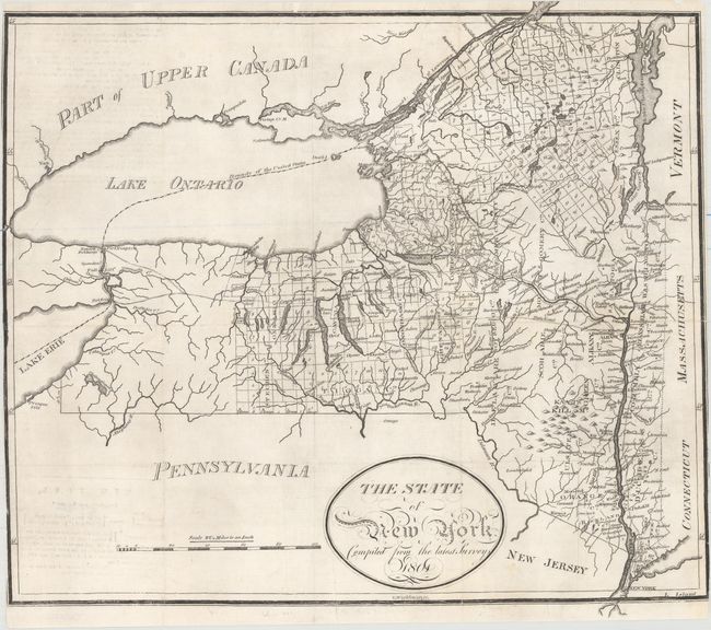
MapMaker: |
Thomas Wightman
|
|
| |
| |
Subject: |
New York |
|
| |
Period/Size: |
1801 / 14.6" x 16.5" (37.1 x 42.0 cm)
|
|
| |
Color: |
Black & White
|
|
| |
Condition: |
(B+) A crisp impression issued folding, now flattened, with professional repairs to several small tears and a 3" tear at top left. There is minor offsetting at left from an opposing page of text and a single worm hole in Steuben County. The margins have (condition help) |
|
| |
Source: |
|
|
| |
References: |
|
|
| |
|
|
| Sales Information |
| |
| |
Price: |
|
|
| |
| |
Offered by: |
Old World Auctions |
|
| |
Catalog: |
Auction No. 154 - Antique Maps, Charts, Atlases & Globes (9277) |
|
| |
Lot/Item #: |
241 |
|
| |
| |
Date: |
09/2015
|
|
| |
| |
|