Title:
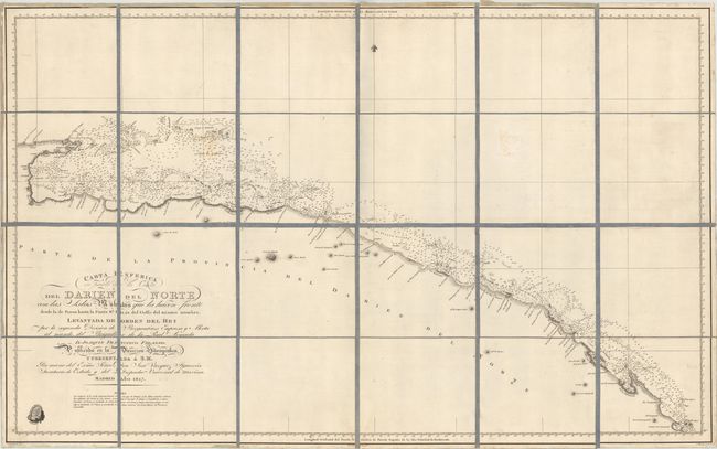
“Carta Esferica de Parte de la Costa del Darien del Norte con las Islas Mulatas que la Hacen Frente desde la de Pinos Hasta la Punta Sn. Blas del Golfo del Mismo Nombre...”
Map Maker:
Direccion de Hidrografia
This scarce Spanish chart depicts the northern coa... (full text available to subscribers)
| Item Detail |
| |
| |
MapMaker: |
Direccion de Hidrografia
|
|
| |
| |
Subject: |
Northern Panama |
|
| |
Period/Size: |
1817 / 23.7" x 38.0" (60.2 x 96.6 cm)
|
|
| |
Color: |
Black & White
|
|
| |
Condition: |
(B+) Very minor soiling with a faint stain at top right. (condition help) |
|
| |
Source: |
|
|
| |
References: |
|
|
| |
|
|
| Sales Information |
| |
| |
Price: |
|
|
| |
| |
Offered by: |
Old World Auctions |
|
| |
Catalog: |
Auction No. 154 - Antique Maps, Charts, Atlases & Globes (9277) |
|
| |
Lot/Item #: |
313 |
|
| |
| |
Date: |
09/2015
|
|
| |
| |
|
Antique Maps - Valuation and Pricing, Descriptions, Resources |
|
Home |
Information |
Search |
Register |
Contact Us |
Site Map
Americana Exchange, Inc. © 1999 - 2024 Americana Exchange, Inc.. All rights reserved.
OldMaps.com, the OldMaps.com logo and
AMPR are service marks or registered service marks of Americana Exchange, Inc..
|