Title:
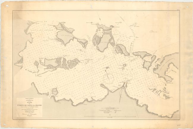
“Mar de las Antillas. Costa Norte de Cuba. Plano del Puerto de Sagua la Grande Levantado en 1858 por los Sres. de Bernardo y Morena...”
Map Maker:
Direccion de Hidrografia
This large-scale chart depicts the northern coast ... (full text available to subscribers)
| Item Detail |
| |
| |
MapMaker: |
Direccion de Hidrografia
|
|
| |
| |
Subject: |
Northern Cuba |
|
| |
Period/Size: |
1885 / 23.1" x 34.9" (58.7 x 88.7 cm)
|
|
| |
Color: |
Black & White
|
|
| |
Condition: |
(B+) Light soiling with several holes and one edge tear in the blank margins, all far from map image. (condition help) |
|
| |
Source: |
|
|
| |
References: |
|
|
| |
|
|
| Sales Information |
| |
| |
Price: |
|
|
| |
| |
Offered by: |
Old World Auctions |
|
| |
Catalog: |
Auction No. 154 - Antique Maps, Charts, Atlases & Globes (9277) |
|
| |
Lot/Item #: |
330 |
|
| |
| |
Date: |
09/2015
|
|
| |
| |
|
Antique Maps - Valuation and Pricing, Descriptions, Resources |
|
Home |
Information |
Search |
Register |
Contact Us |
Site Map
Americana Exchange, Inc. © 1999 - 2024 Americana Exchange, Inc.. All rights reserved.
OldMaps.com, the OldMaps.com logo and
AMPR are service marks or registered service marks of Americana Exchange, Inc..
|