| Item Detail |
| |
| |
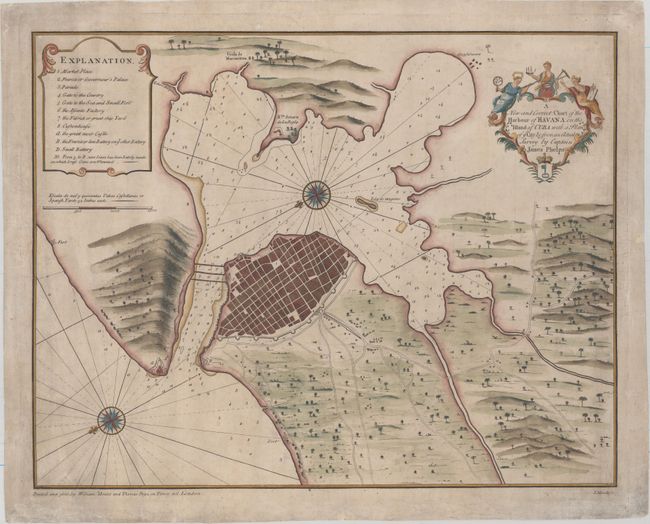
MapMaker: |
Mount & Page
|
|
| |
| |
Subject: |
Havana, Cuba |
|
| |
Period/Size: |
1760 / 16.8" x 21.4" (42.7 x 54.4 cm)
|
|
| |
Color: |
Colored
|
|
| |
Condition: |
(B+) Watermarked paper with attractive color and light surface soil in the map. The map appears to have been originally mounted on linen, which has now been removed. There are a couple of small, minor repairs in map image, with more significant repairs (condition help) |
|
| |
Source: |
|
|
| |
References: |
Cueto #161; Shirley (BL Atlases) M.M&P-11a #20. |
|
| |
|
|
| Sales Information |
| |
| |
Price: |
|
|
| |
| |
Offered by: |
Old World Auctions |
|
| |
Catalog: |
Auction No. 154 - Antique Maps, Charts, Atlases & Globes (9277) |
|
| |
Lot/Item #: |
332 |
|
| |
| |
Date: |
09/2015
|
|
| |
| |
|